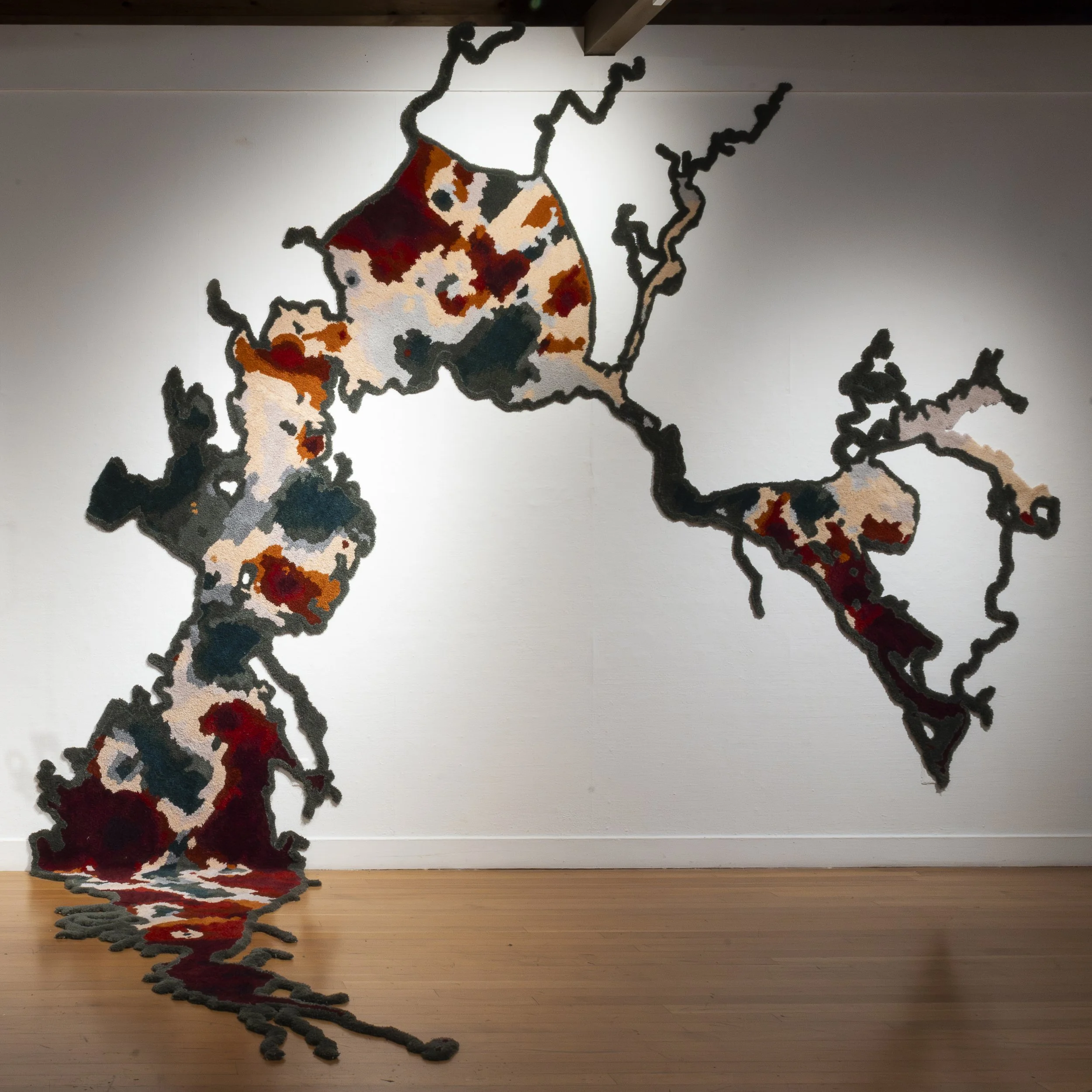
methylmercury in water, san francisco bay, 2006-2015.
This tufted wool rug is a component of [obstructed view of the house through the trees with the road visible on the left side in the foreground.] or, black point reinterpretive site, a collaborative installation by Torreya Cummings and Sarah Lowe, curated by Elena Gross.
The spectrum of colors in the rug indicate the total levels of methylmercury found in SF Bay water in samples collected from 2006-2015 and presented by the San Francisco Estuary Institute in their 2017 Pulse of the Bay report. Reds are the high end (>0.15 ng/L), whites are the midrange, greens are the low end (<0.025ng/L). Methylmercury levels are indicative of the amount of mercury that accumulates in the food web, with consequences across all species endemic to the Bay Area, including humans that eat fish caught there. The high levels of mercury contamination are the result of historic mining activities all across the San Francisco Bay Watershed from the High Sierras on down; the most significant source is the New Almaden Mercury Mining District south of San Jose, historically the largest mercury mining region in the United States. Significant cleanup efforts focused on that area have been reducing the runoff from New Almaden into the Guadalupe River watershed, but estimates of how long it will take for the San Francisco Bay to recover completely are on the order of ten thousand years.